Snow, blizzard conditions in Southern MN just before the buzzer sounds on winter
Spring is due to arrive in five short days, and Mother Nature plans to sneak in one more storm before winter expires.
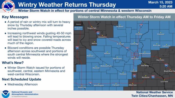
The National Weather Service has placed most of southern Minnesota under a Winter Storm Watch, effective Thursday from 1 p.m. through 7 a.m. Friday morning.
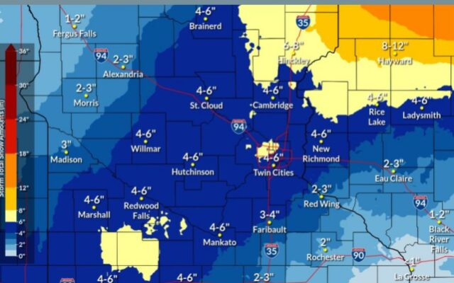
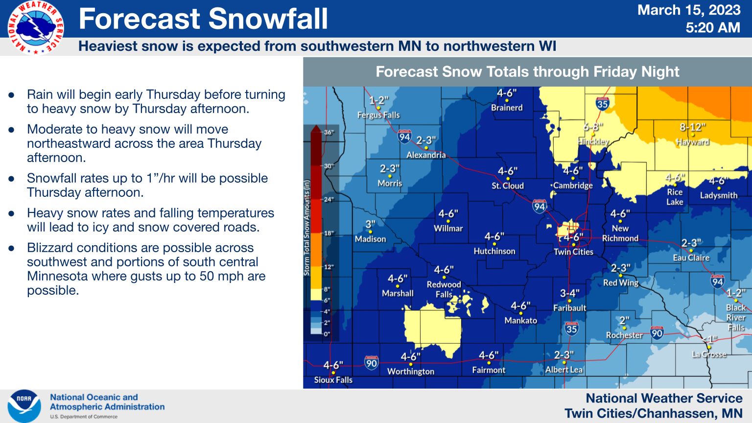
Rain will begin falling in the Mankato area at around 9 a.m. Thursday, but precipitation will switch to heavy snow in the afternoon. NWS says snow rates could be up to one inch per hour. Most of southern Minnesota can expect 4 to 6 inches of total snowfall, with higher amounts forecasted in areas like Cottonwood County, and lower amounts to the southeast, in areas surrounding Albert Lea.

The heavy snow rates will combine with falling temperatures and wind gusts up to 45 mph, potentially creating icy roads and blizzard conditions.
Strong winds will create blustery conditions through Saturday, with temperatures falling to near zero overnight.
The sun will make its glorious return on Sunday with highs in the mid-20’s and calm winds.