Snow more! March storm could drop around 10 inches on Mankato area
A March snowstorm could drop around ten inches of snow on Mankato and the surrounding areas this week.
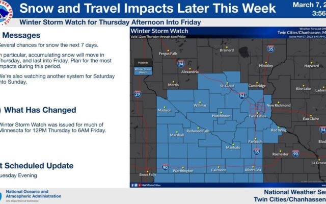
The National Weather Service has issued a Winter Storm Watch that will go into effect at noon Thursday.
The snow should start sometime after 1 p.m., according to NWS, with periods of heavy snow, along with gusty winds up to 30 mph. Blowing snow could create hazardous driving conditions and poor visibility.
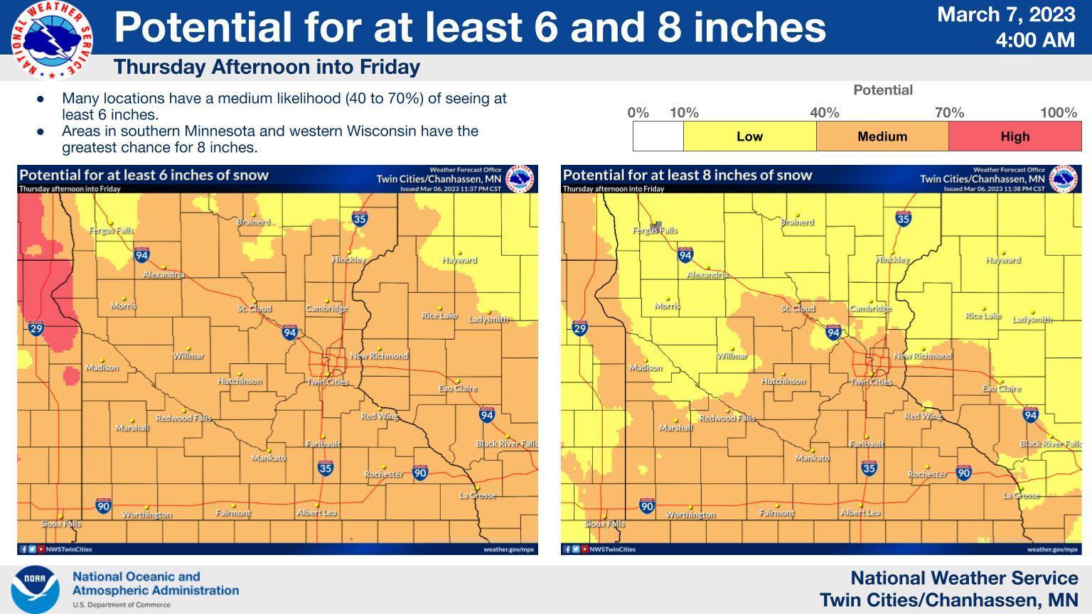
Snowfall totals will range from 5 to 11 inches in the Mankato area, but forecasters say southern Minnesota has the greatest chance to see at least 8 inches of snowfall.
Thursday isn’t the end (or the beginning) of the March snow. Wednesday’s forecast shows a possibility for an inch of snowfall during the daytime, with the potential for more on Wednesday night.
Thursday’s storm will produce snowfall into the early morning hours of Friday, with flakes expected to exit by about 7 a.m.
Saturday carries a 40 percent chance of snow, and there’s a 50/50 shot for more white stuff on Sunday.
The sun is expected to make its return on Monday, with a 30-degree high temperature.
Popular Stories
Recent Stories